wahl.de relaunched, just in time for Berlin's election
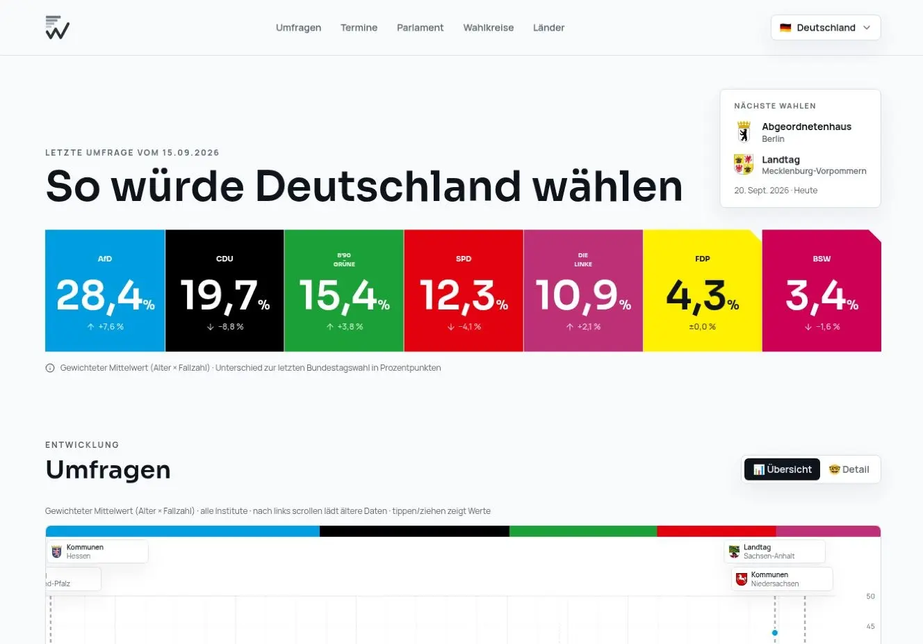
wahl.de is the brainchild of my friend Klas. We first built the site together for the 2009 Bundestag election, and for this latest iteration I had the pleasure of working with him again. We have just relaunched it ahead of another important moment: Berlin’s election on Sunday, September 20.
The goal was simple. German election data should be quick to understand without becoming shallow. The new wahl.de starts with a clean national snapshot: current polling, movement since the last election, upcoming votes and the composition of parliament. The visual language is deliberately crisp, so the numbers do the work.
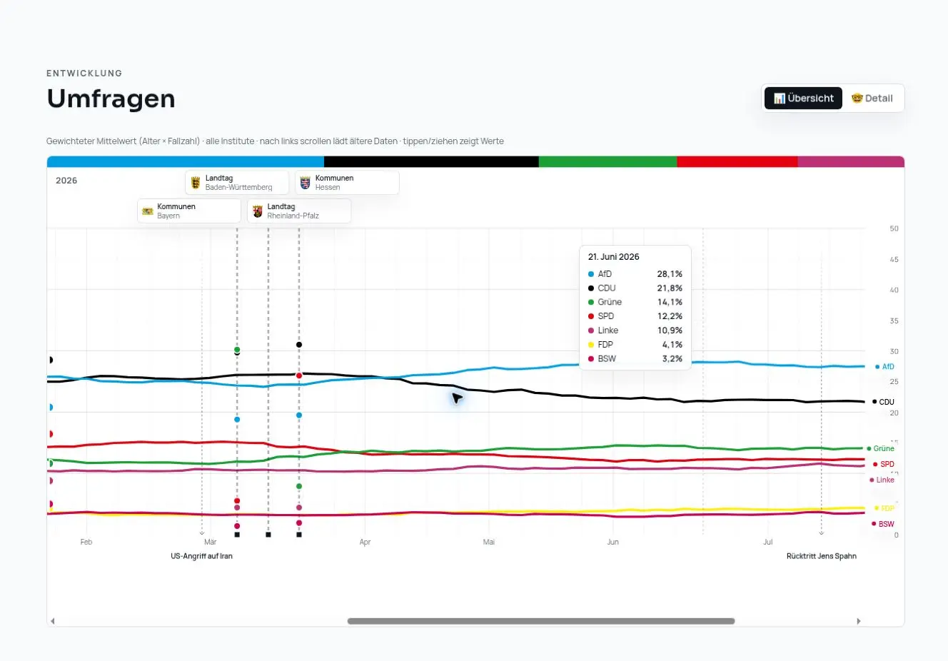
The polling timeline adds the context behind the snapshot. Elections and political events sit directly against the party lines; in this view, “US-Angriff auf Iran” is visible on the chart, so you can read the event and the movement around it together.
Germany, all the way down
The part I like most is how easily you can move from the national picture into the geography underneath it.
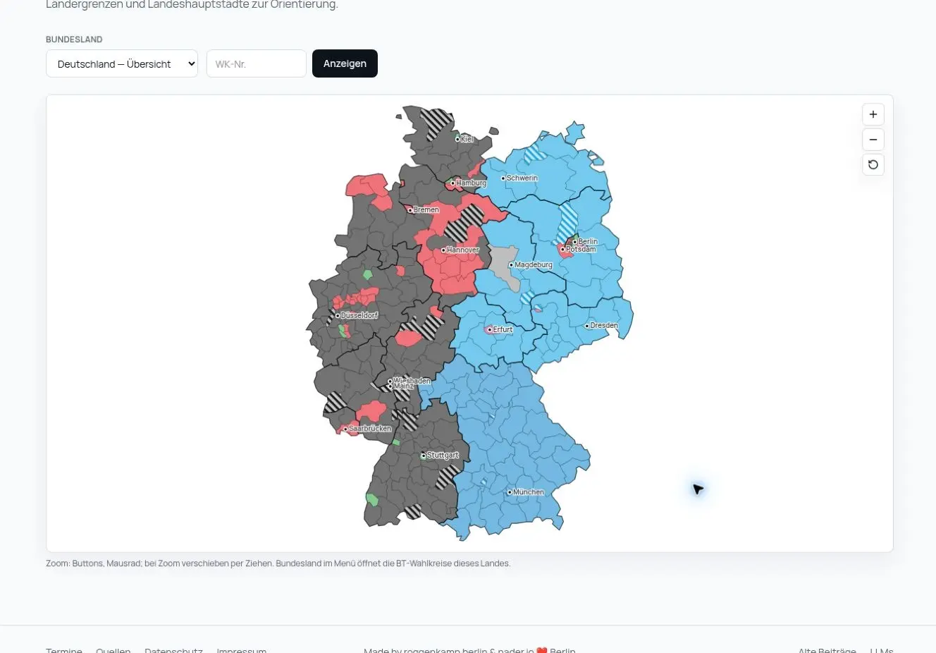
The Germany map shows every Bundestag constituency, coloured by the party holding the current direct mandate. Vacant seats are hatched, while state borders and capitals keep the map readable. You can zoom, choose a federal state or jump directly to a constituency number.
From there, each district becomes its own small data story.
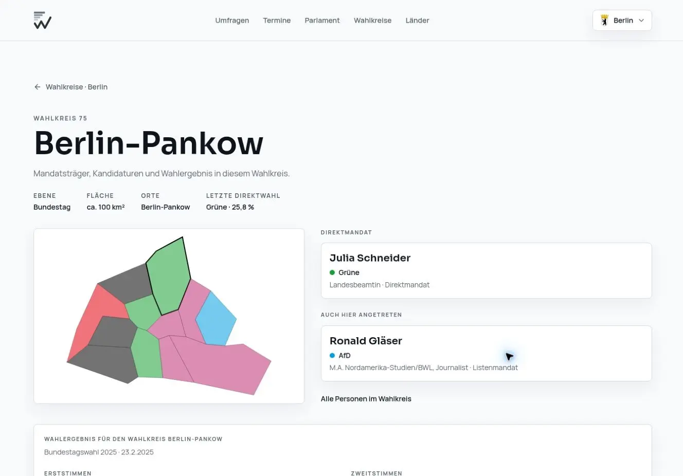
A constituency page brings together the map, its current representative, other candidates, and the first- and second-vote results. The Berlin-Pankow view above is a good example: you can see the shape of the district and the political detail behind it in the same place.
That balance was the point of the relaunch. wahl.de should work when you want the answer in ten seconds, but it should also reward the next click, and the one after that.
With Berlin voting on September 20, it felt like exactly the right moment to put it live.
Explore it at wahl.de.